CANARI scientists reflect on 2025 climate extremes
The new climate “normal”
The 2025 annual State of the UK Climate report, published in the International Journal of Climatology, led by the Met Office, features UKCEH scientists from the CANARI programme (Jamie Hannaford and Lucy Barker).
The report puts climate extremes in 2025 and recent decades into a historical context. In 2025, the UK recorded its warmest and sunniest year on record, with high spring and summer temperatures. Spring 2025 was the driest for England for over 100 years, with most of England and Wales receiving less than half of the 1991-2020 average rainfall. Spring and summer 2025 combined saw less than 40% of 1991–2020 average rainfall in the driest areas, which led to notably to exceptionally low river flows and the the second lowest total flow of rivers in England in a series from 1961, lower even than several other major summer droughts except 1976.
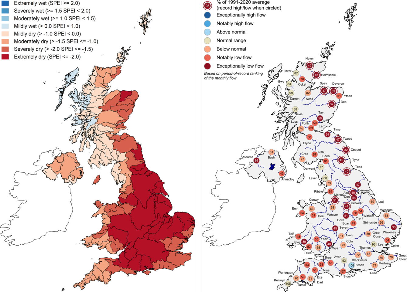
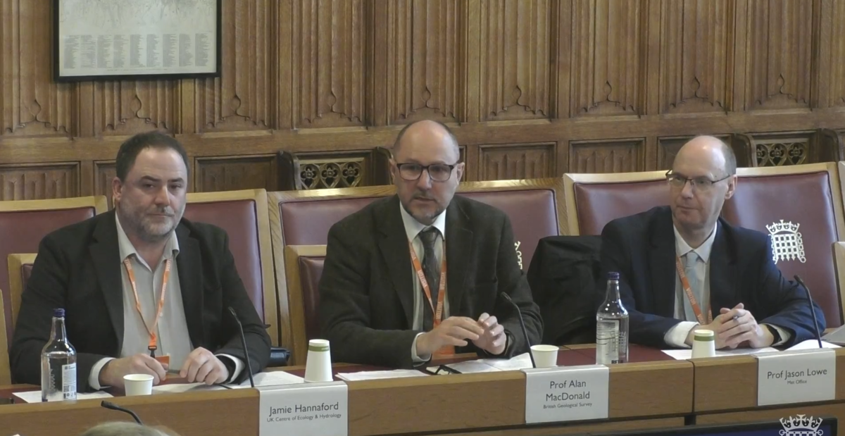
“Lucy Barker, Senior Hydrological Analyst at the UK Centre for Ecology & Hydrology said “Last year was memorable for the intense drought over the spring and summer, when we saw very low river flows across the country, as well as significant impacts on water supplies, agriculture and the environment. River flows over the spring and summer approached or were lower than other recent droughts like those in 2018 and 2022, as well as the major drought of 1976.”
Weather “whiplash”
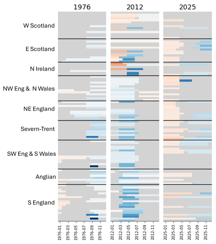
The 2025 drought ended with an abrupt transition to wetter than average conditions in the autumn and across winter 2026, which ranks among the wettest on record (since the series began in 1836) for some parts of the UK. CANARI scientist Rachael Armitage reflects in a blog the rapid drought termination in 2025, similar “whiplash” events in the past and whether these rapid swings between wet and dry conditions will increase in the future. The droughts in both 1976 and 2012 ended with a sudden shift to widespread wet conditions (a dry-wet transition). The heatmaps highlight the difference in the 2025 drought, which not only ended with a dry-wet transition but also began with a wet-dry transition for much of the country.
Read more from Rachael’s blog here: https://www.ceh.ac.uk/news-and-media/blogs/reflecting-2025-year-weather-whiplash